Selaus asiasanan mukaan kokoelmassa 1. Suomi osana Eurooppaa, Ruotsia, Venäjää
Viitteet 1-20 / 93
-
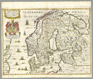
A generall mapp of Scandinavia, where are ye estates and kingdomes of Danemark, Norway and Sweden by Monsieur Sanson
(London: Richard Blome, [1693?], 1693) -
A generall mappe of Scandinavia, where are the estates and kingdomes of Danemark, Norway, and Sweden
(London: Richard Blome, [1670], 1670) -
A new map of Denmark and Sweden: according to ye newest and most exact observations
([London]: printed for H. Moll over against Devereux Court without Temple Bar in the Strand Iohn Bowles at the Black Horse in Cornhill, Thomas Bowles print & mapseller next to the Chapter House in St. Pauls Church yard and by Philip Overton map & printseller near S. Dunstans Church Fleetstreet, 1712, 1712) -
A new map of Sweden, Denmark and Norway, from the latest authorities
(London: J. Cary engraver & map seller no. 181 Strand, Aug. 1st 1801, 1801) -
A new map of the Baltick & c.: shewing all the dominions about it with ye great or post roads and principal cross-roads
([London]: [Herman Moll], ca. 1720, 1720) -
A new map of the Northern States containing the Kingdoms of Sweden, Denmark, and Norway; with the western parts of Russia, Livonia, Courland & ca.
(London: printed for Robert Sayer, 1790, 1790) -
A new map of the Northern States containing the Kingdoms of Sweden, Denmark, and Norway; with the western parts of Russia, Livonia, Courland & ca.
(London: printed for Robert Sayer, 1788, 1788) -
Baltia, quae et Scandia, Finningia, Cimbrica Chersonesu & c.
([Paris]: [Jean le Clere], 1703, 1703) -
Baltia, quae et Scandia, Finningia, Cimbrica Chersonesu & c.
([Paris]: [Sanson?], 1654, 1654) -
Bowles's New Pocket Map of the Kingdoms of Sweden and Norway, from the maps of Homan, published at Nuremberg
(No. 69 in St. Pauls Church Yard London: printed for the proprietor Carington Bowles, [1779?], 1779) -
Carte de l'Empire des Russies en Europe: partie septentrionale
(A Paris: chez Bourgoin Graveur rue de la Harpe vis-a-vis le Passage des Jacobins à côté du Caffé de Condé, 1765, 1765) -
Carte de la partie européenne de l'empire de Russie, avec l'indication des chemins de poste, ainsi que des douanes frontières et de la repartition actuelle en gouvernements et districts /
(St. Peterbourg :, Depôt imperial des cartes, 1809, 1809) -
Carte de la partie meridionale du royaume de Suede avec une table des provinces et villes principales
([Amsterdam]: [F. l'Honore & Chatelain], 1718, 1718) -
Carte de la partie septentrionale du royaume de Suede avec une table des provinces et villes principales
([Amsterdam]: [F. l'Honore & Chatelain], 1718, 1718) -
Carte des estats de la couronne de Suede avec des remarques et des tables tres instructives
([Amsterdam]: [F. l'Honore & Chatelain], 1718, 1718) -
Charta som wisar sträckningen så wäl af Land- och Fiäll-ryggen som gränsen imellan Swerige och Norrige för den delen som de, ifrån Rutefiället til Haldefiällen, mäst äro i följe med hwarandra
([Stockholm]: kustantaja tuntematon [1771?], 1771) -
Charta som wisar sträckningen, så wäl af land- och fiäll-ryggarne, sedan de i Halde Fiällen skiljas åt som norra delen af Riks-gränsen imellan Swerige och Norrige
([Stockholm]: kustantaja tuntematon 1771, 1771) -
Charta öfver Luleå lappmark samt Luleå, Råneå, Öfver och Nederkalix socknar i Westerbottens höfdingedöme
([Stockholm]: S. G. Hermelin 1801, 1801) -
Charta öfver Wästerbottn och Svenske Lappmarcken
([Stockholm]: S. G. Hermelin, 1796, 1796) -
Charte von dem Europäischen Russland / berichtiget im Jahre 1817.
(Weimar : im Verlage des Geograph: Instituts, 1820)